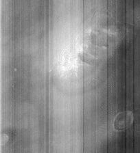
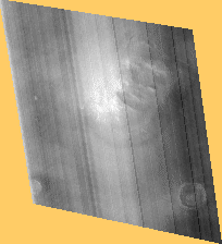
Fig. 1 Original MGS Image Fig. 2 Image Oriented to Vertical View
Note, the contrast of these images has been increased by 87% percent.
Fig. 1 Original
MGS Image
Fig. 2 Image Oriented to Vertical View
Note, the contrast
of these images has been increased by 87% percent.
Note: The MGS imager works in a similar manner to a scanner. The orbiter
provides the motion and alignment when making the image. Later, an earthbound
computer can correct for the distortion inherent in the process by using
the known altitude and attitude of the spacecraft at the time of the scan,
and making assumptions about the scanned terrain features.
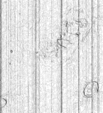
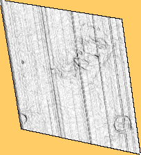
Fig. 3 Used
Edge Finder on MGS Image
Fig. 4 Used Edge Finder on Vertical View
The rectangle is
faintly visible in both of these images.
The stripes are probably from manufacturing flaws in the MGS imager. They do explain some subtle breaks through the face and rectangle that can be seen in the enhanced image. I think the enhancer removed the lines and made assumptions about what should be in there, then filled in the blanks. I am willing bet that the enhancer made some similar assumptions about the features in the bright area at the center of the image.